
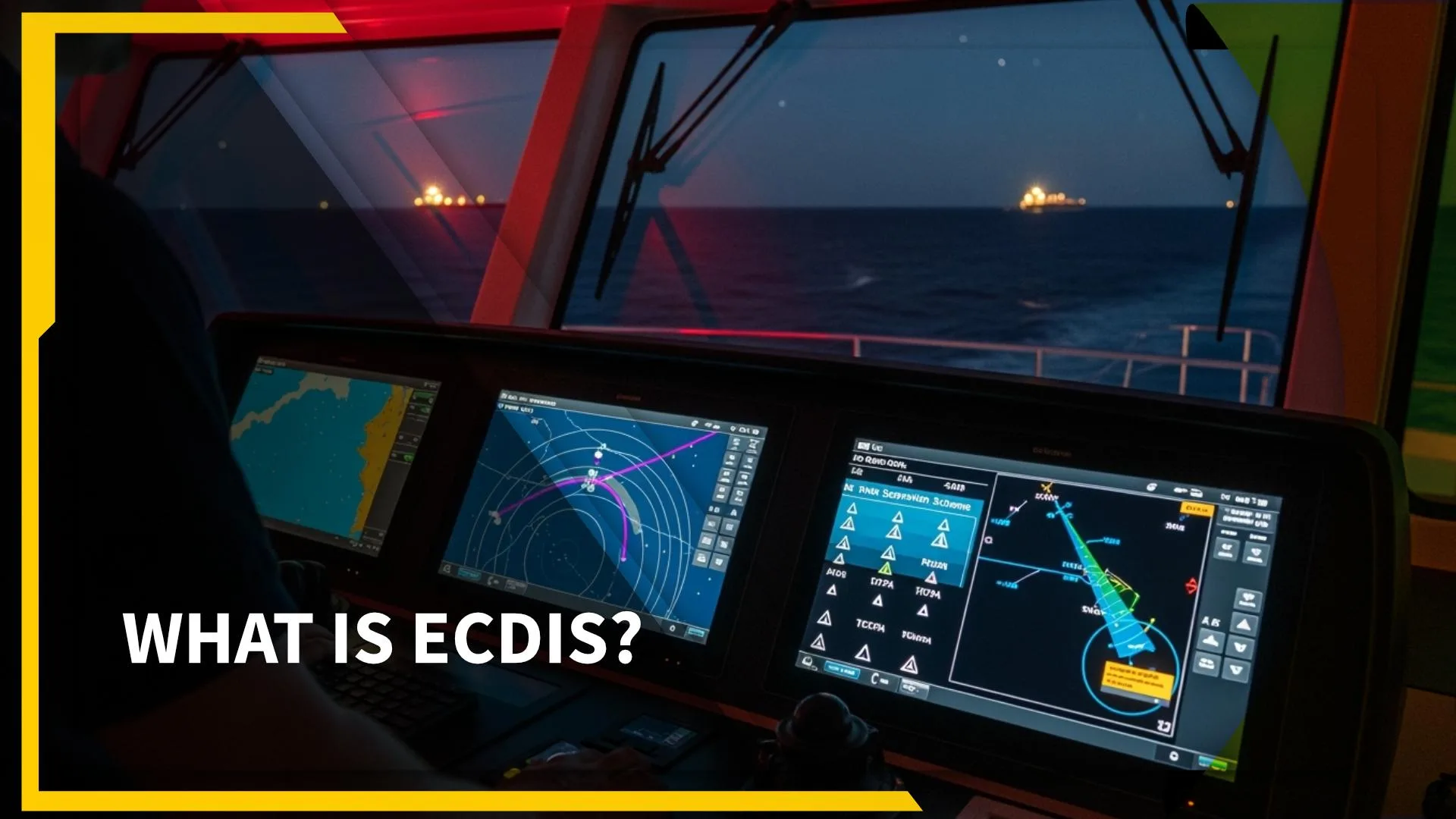
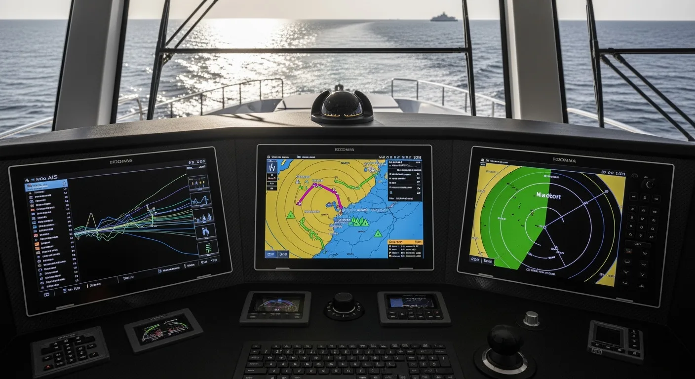
ECDIS stands for Electronic Chart Display and Information System. In simple terms, it is a digital navigation solution that has replaced paper charts on most commercial and private vessels. But ECDIS is more than a digital map. It is a powerful system that combines real-time position data, navigational warnings, and safety features into one central platform. For yachting professionals and management companies, this technology has reshaped how voyages are planned and executed.
The Leap From Paper Charts To Electronic Navigation
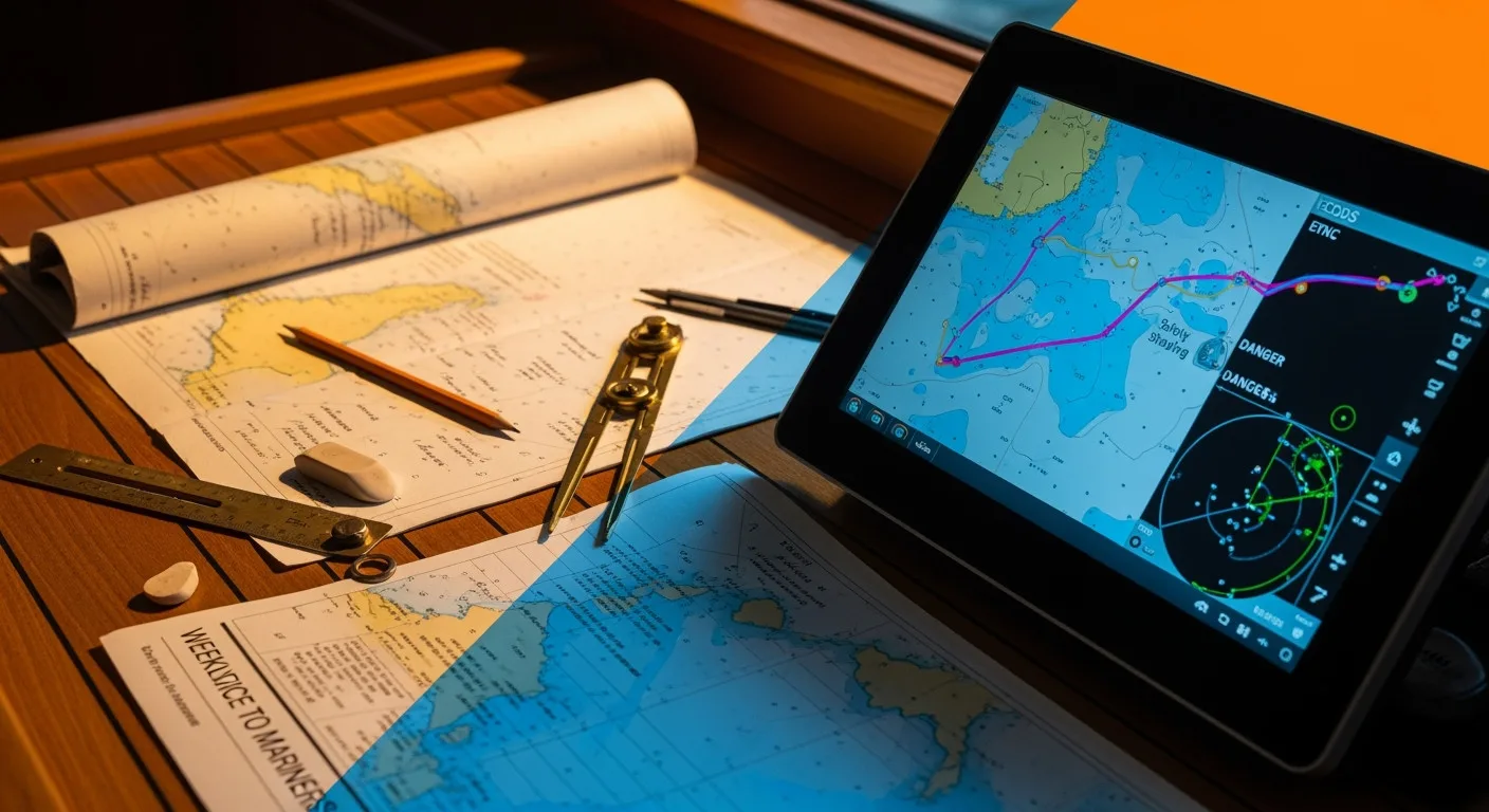
For centuries, mariners relied on paper charts, compasses, and careful plotting to guide them across the seas. These charts worked, but they required constant updating and plenty of manual calculations. With yachts now crossing oceans faster and with more advanced propulsion system setups, accuracy and efficiency have become critical.
ECDIS solves many of those old problems. It automatically updates navigational data, integrates with GPS and radar, and highlights hazards such as shallow waters or restricted zones. Imagine trying to cross the Mediterranean at night using only paper charts versus having ECDIS highlighting your route and alerting you if you drift off course. The difference is night and day.
How ECDIS Actually Works
At its core, ECDIS combines two key components:
-
Electronic charts: These are official, standardized maps called ENCs (Electronic Navigational Charts). They are approved by authorities and carry the same legal weight as paper charts.
-
Integration with onboard systems: ECDIS pulls data from GPS, radar, AIS (Automatic Identification System), and other navigation equipment. This creates a real-time picture of the yacht’s location, movements of other vessels, and any navigational dangers ahead.
The system can even suggest safe routes based on regulations like SOLAS, MARPOL, or IMO guidelines. For example, if ballast water treatment restrictions apply in a certain area, an ECDIS-equipped yacht will show this clearly, reducing the risk of compliance errors.
Common Misconceptions: ECDIS vs. Electronic Charts
A common mistake is thinking ECDIS is just “Google Maps for yachts.” In reality, it is far more advanced. Tablet-based navigation apps or electronic chart plotters might look similar but don’t carry the same legal or regulatory status.
The difference matters. On large yachts, especially those over a certain gross tonnage (GT), ECDIS is mandatory under international regulations. Simply having an iPad app doesn’t cut it when it comes to inspections, safety checks, or insurance requirements.
Why ECDIS Matters In The Yachting World
For yacht crew and management, ECDIS offers more than just easier navigation:
-
Safety: Automatic alarms warn of grounding risks, collision dangers, or deviations from the planned route. This is crucial during long passages or a sea trial after a major refit.
-
Efficiency: Voyage planning, once a labor-intensive process, can now be done quickly and with greater accuracy. This saves time and reduces the chance of human error.
-
Compliance: International regulations demand adherence to strict navigational standards. ECDIS ensures yachts stay within those requirements, which helps during inspections related to load line rules, environmental standards like MARPOL, or crew welfare checks under MLC.
-
Integration: On refitted superyachts, ECDIS often works alongside upgraded systems such as HVAC, stabilizer technology, or electronic monitoring. Everything contributes to smoother, safer operations.
Challenges And Training Requirements
While ECDIS is a game-changer, it isn’t foolproof. The system relies on correct chart updates and proper crew training. Overconfidence in automation can be dangerous if officers forget the basics of navigation. International rules even require formal ECDIS training for deck officers on larger yachts.
For smaller yachts or beginners, learning ECDIS may feel overwhelming at first. But like any tool, confidence comes with practice. Knowing how to use manual plotting alongside ECDIS provides a balance between tradition and technology.
ECDIS And The Future Of Yachting
As yachts continue to grow in size and complexity, ECDIS will remain a cornerstone of safe navigation. It is already evolving, with features like integration into bridge management systems, predictive routing, and links to weather updates in real time. For refit projects, ensuring that ECDIS is properly installed, updated, and integrated with other systems is just as important as visible upgrades.
The future may bring even smarter navigation tools, but the principle will remain the same: the safer and more efficient the bridge, the better the experience for owners, guests, and crew.
For anyone in yachting, from new deckhands to yacht management professionals, understanding ECDIS is not optional. It is the backbone of modern navigation, blending tradition with innovation. Think of it as both a safety net and a decision-making partner on every voyage. Whether you are plotting your first Mediterranean crossing or managing a full refit brief, ECDIS is the system that keeps the journey safe, efficient, and compliant.
FAQ: ECDIS in Yachting
What is the main purpose of ECDIS on a yacht?
ECDIS is designed to provide safe and efficient navigation by replacing paper charts with digital ones. It integrates GPS, radar, and other systems to give real-time information, alerts, and compliance guidance during voyages.
Is ECDIS mandatory for all yachts?
No, ECDIS is not required on every yacht. It becomes mandatory for larger vessels, particularly those over a certain gross tonnage (GT), under international conventions like SOLAS. Smaller private yachts may use ECDIS voluntarily for safety and convenience.
How does ECDIS help with compliance to maritime regulations?
ECDIS highlights restricted areas, environmental zones, and safety requirements based on international rules like MARPOL, IMO, and MLC. This ensures yacht operations stay within legal boundaries, reducing the risk of penalties or detentions during inspections.
Can ECDIS replace traditional navigation skills?
While ECDIS is a powerful tool, it should not replace fundamental navigation knowledge. Crew members must still understand manual chart plotting and position fixing, since overreliance on automation can lead to mistakes if the system fails or data is outdated.
How often should ECDIS charts be updated?
Electronic Navigational Charts (ENCs) need regular updates, typically weekly, to remain compliant and safe. Most modern systems receive these updates automatically, but the crew is responsible for verifying that the yacht’s database is current.
What training do yacht crews need to use ECDIS?
Officers on larger yachts are required to complete official ECDIS training courses. Even on smaller yachts, crews should practice using the system, as familiarity improves safety and confidence when navigating under pressure.
Can ECDIS be used during a sea trial after a refit?
Yes, ECDIS is particularly useful during a sea trial. It records navigation data, checks alarms, and confirms the accuracy of installed or upgraded equipment, ensuring the yacht is safe and ready for service.
How does ECDIS integrate with other yacht systems?
ECDIS can link with systems like autopilot, AIS, and even onboard technologies such as stabilizer and monitoring equipment. This creates a connected bridge environment where navigation, safety, and comfort work together seamlessly.


[…] Electronic Chart Display and Information System (ECDIS) is one of the most important tools on modern yachts, replacing paper charts with digital […]